Naikoon Estates, Queen Charlotte Islands, Lot 3
| Listing Number: | PR15C |
|---|---|
| Size: | 3.73 Acres |
| Map Reference: | 103J |
| Price: | SOLD |
| Legal: | Lot 3, Subdivision Plan of Part of Lot 1, District Lot 839A, Plan PRP44893 Queen Charlotte Land District |
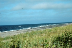
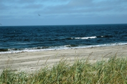
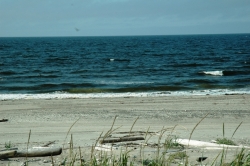
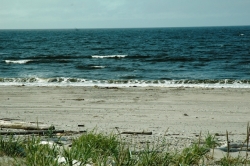
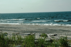
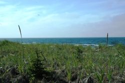
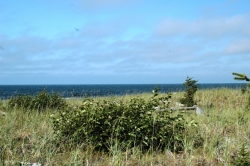
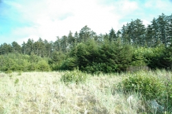
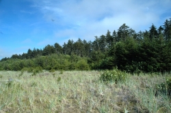
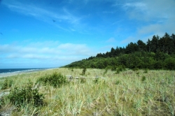
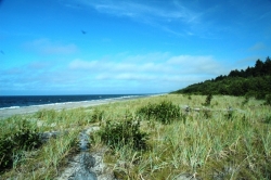
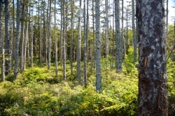
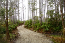
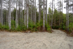
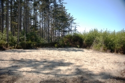
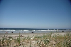
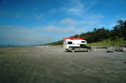
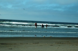
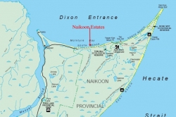
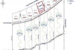
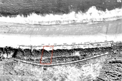
| Description: | The beach in front of this lot is part of the most spectacular beachfront in British Columbia. Lot 3 has 287 ft (87 m) of oceanfront. Between the lot and the high water mark the beach consists mostly of sand dunes. The beach between the sand dunes and the ocean is wide and very flat and flat enough to drive a car on. You can stand on the beach and look in either direction at miles of beautiful beach as far as the eye can see. This property has direct access to North Beach and enjoys excellent views of Dixon entrance. The southerly parts of the lot are wooded in alder, spruce and cedar. The northerly part of the lot is covered in sand dunes. Tow Hill road is its south boundary. |
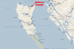
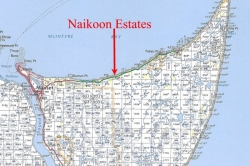
| Location: | The property is located approximately 8.7 miles (14 km) east of Masset on the north beach, in the north section of Naikoon Park, which is located on the north shore of Graham Island in the Queen Charlottes. The Queen Charlotte Islands are 450 miles (724 km) north of Vancouver and 80 miles (129 km) west of Prince Rupert and are the most westerly islands in Canada. |
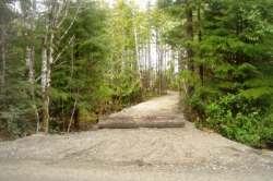
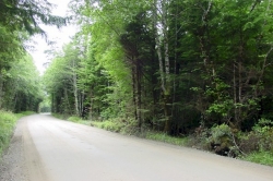
| Access: | The Queen Charlotte Islands can be reached by plane or ferry with daily flights on Air Canada to Sandspit (on Moresby Island) from Vancouver. There is also air service from Vancouver to Masset with Pacific Coastal Airlines. North Pacific Seaplanes offers air service from Prince Rupert to Masset. BC Ferries services the Islands from Prince Rupert with 5 sailing’s a week in summer and 3 in winter from Prince Rupert to Skidegate on Graham Island in the Queen Charlottes. Sailing time is approximately 6 hours. Rental cars are available in Sandspit, Masset and Queen Charlotte City. From Sandspit drive 6 miles (10 km) to the Kwuna ferry to Skidegate. From Skidegate travel north to Masset on Highway 16 (an extension of the Yellowhead Hwy) for 63 miles (101 km). From Masset travel approximately 8.7 miles (14 km) on Tow Hill road to the lot. A majority of Tow Hill road is partially paved. Directly in front of the lot is good gravel surface. |
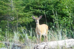
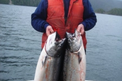
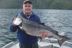
| Recreation: | The Queen Charlottes is world-renowned for its fishing, both fresh and saltwater. There are freshwater streams in abundance as well as the ocean itself, to lure adventurous fishers to this unique spot. From May through August, millions of fish pass by the Queen Charlotte Islands as they head back to the spawning grounds. All five species of salmon can be found in these waters at this time: Chinook (kings, springs, tyees), Chum (dogs), Sockeye (reds), Coho (silvers), and Pinks (Humpies). Starting in mid-May, the fish appear on the northern Graham Island coast and follow the herring and needlefish down the coastline. This first run of fish are heading back to the Nass and Skeena Rivers on the mainland, and can average 25-35 lbs, although they can get up to 60-70 lbs. Coho will show up in early July, and by late August can weigh over 20 lbs. Steelheads are the winter fishery on the islands, with the first run showing up in October, and running through to March. Peak months are December and January. Spring Halibut can weigh over 40 pounds. Crabbing along North Beach is available for most of the year. North Beach is considered by many to be one of the best razor clam beaches in the world. Dungeness crabs can also be caught in this are. Some of the best dinners in the world can be found just meters from your lot. All you need to do is take your crab net and walk along the beach. Hiking, biking and walking on the beaches or numerous trails provides enjoyment as well as relaxation for the outdoor enthusiasts. One of Masset’s attractions is the world famous Delkatla Wildlife Sanctuary. This sanctuary is on the southern route for migratory birds. At least 140 different species have been seen at different times. The once endangered Trumpeter Swan winters here and the Sandhill Crane spends the summer here. The Sanctuary is becoming internationally recognized for its importance as a nesting, feeding and wintering area. Naikoon Provincial Park , one of the two provincial parks on the Charlottes, consists of 72,660 ha (179,493 acres) of low bog land and superb sand dunes, with forests occurring only along river valleys and hills. Naikoon reaches out into Hecate Strait and culminates in Rose Spit, an ecological reserve and excellent spot for watching birds migrating south. Naikoon Park is known for its beautiful scenery, excellent hiking trails and wilderness campsites. The Tlell River is famous for its coho salmon and steelhead trout. Queen Charlottes Islands are well known for their abundant wildlife especially hundreds of small deer and seeing fifty to sixty in a day is not uncommon. The venison from these islands is superb and known throughout British Columbia as some of the best venison in the province. There are also herds of elk on these islands. The Queen Charlotte Islands offer some of the world’s best ocean fishing for salmon and halibut, great steelhead rivers, trout fishing in lakes and rivers, Queen Charlotte Islands is a legend among sports fisherman worldwide with it’s first class lodges such as the Peregrine Lodge, Queen Charlotte Lodge and Langara Lodge. Outdoor Recreation activities include sea kayaking, some of the best razor clam beaches, beachcombing, photography, camping, numerous hiking trails, boating, crabbing, shell fishing and so much more. |
| Services: | Hydro will be provided to the property line. |
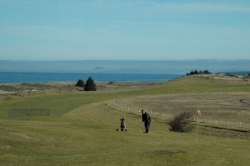
| Area Data: | This area can provide something of interest to everyone; history, archeology, fishing, boating, hiking, biking and more. The four main towns and numerous communities on the island all have something unique to offer. The island pace is slow and relaxing so you can explore and enjoy at your leisure. Masset (Pop. 965) is 25 miles (40 km) north of Port Clements. Masset, on Masset Sound is the largest community in the Charlottes. Located at the end of Highway 16 amenities include full tourist services, restaurants, accommodations, RV park open year-round and groceries. Boat launching and moorage facilities are available along with Canada’s most northwesterly 18 hole golf course Dixon Entrance Golf and Country Club. Visit Old Masset, only minutes away where local Haida artists display their silver, gold, argillite carvings and jewelry. Road access available to the north end of Naikoon Provincial Park on Tow Hill Road. Tow Hill’s (109 meter) 358 feet basalt cliff is the most prominent landmark on the northeast coast. The Queen Charlotte Islands are a triangular archipelago of some 200 islands, most of them small and uninhabited, covering an area of 9,596 sq. km, running (251 km) 156 miles from south to north, and (84 km) 52 miles west to east. They are separated from the mainland by Hecate Strait, to the north, ranging in width from (50km) 31 feet to (130km) 81 miles. The largest islands are Graham to the north, and Moresby, to the south. Graham Island is the largest, most accessible, and most populated of the islands. Visitors come by ferry from Prince Rupert and dock at Skidegate. The average actual rainfall is about 125 cm. This is only slightly higher than the average actual rainfall at Vancouver International Airport, and less than that of North Vancouver. The isolation and climate make the islands distinctly different from the mainland. Unique subspecies thrive hear, from the largest black bears to tiny saw-whet owls. Luxurious rain forests, wild rocky shorelines and deserted beaches provide superlative wilderness adventures. Queen Charlotte Islands offers excellent fresh and salt water fishing, boating, camping, crabbing, clamming, photography, and kayaking. |
| History: | The Queen Charlotte Islands were the first place in British Columbia discovered and recorded by European, Juan Perez in July 1774. In 1787 British explorer Captain George Dixon named the islands Queen Charlotte for his ship and his Queen some 13 years after Spanish explorer Juan Perez sailed here. The appeal of the Queen Charlottes is their mystique, which comes in part from their isolated, storm-swept landscape. It also comes from the Haida culture. They have been referred to as the Vikings of the Northwest Pacific for their seafaring prowess. The Haida have been strong to survive even the holocaust of smallpox that followed the arrival of the first Europeans in the late 1700’s. At that time the Haida population was an estimated 7,000 distributed throughout the islands. By 1915, the Haida population had dropped to less than 600. Today there are two Haida communities, Old Masset (707) and Skidegate (743). The Haida people make up just 30% of the island’s total population, yet their influence is significant. They participate heavily in the island’s major industries, logging and fishing and tourism also plays an increasing important role. Many Haida artists are barely able to keep up with the demand for their work. |
| Taxes: | 978.27 |
| Zoning: | Rural District R-1
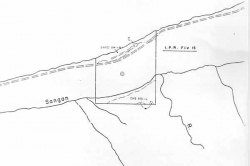
Boundaries By F. Nash in October 1925 & McElhanney & Associates October 2004 |
| Sold Date: | 30/10/2006 |
