Stay in touch with NIHO!


| Listing Number: | PR 35 |
|---|---|
| Size: | DL 1302:131.60 acres |
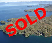
| Price: | SOLD |
| Legal: | District Lot 1302, Land District 14 |
| Description: | This is one of only a few oceanfront properties on the island that has excellent well-sheltered moorage as found in Refuge Bay. The east shore of the property is fairly flat and gently slopes down to the sheltered rock and gravel shoreline, and sandy/ gravely beach, while a portion of the interior of the property is meadow with some wet areas. There is 5,925 feet of ocean frontage on Useless Bay to the west and Refuge Bay to the east. There is also a fresh water creek that runs through the property, entering the ocean in Refuge Bay on the northeast corner. The land rolls gently over a couple of tree covered hills to a steeper western shoreline that is also completely treed. The West Side is not quite as sheltered, but still very accessible, with some very nice sandy/gravely beaches. There are some remains of an old fishing cannery still visible on the northeast corner by Refuge Bay and there is an old road to the cannery coming in from the southeast. These roads connected the various small communities and homesteads many years ago. |
| Location: | This property is located 15 miles (24 kms) south of Prince Rupert on the northern coast of Porcher Island. Porcher Island is a large island just south of Prince Rupert, which is approx. 460 miles (740 km), as the crow flies, north of Vancouver.
|
| Access: | To reach the property you will require to travel either by boat from Prince Rupert down the telegraph passage and then along the north end of Porcher Island through Malice Passage to Refuge Bay, or by float plane which is a 15 minute trip from Prince Rupert. A person can land by boat or plane on either the East Side of the property in Refuge Bay, a very sheltered bay, or on the West Side, also on a good beach, and still quite sheltered.
|
| Recreation: | Fishermen come from near and far to fish in this area. Goble Point and Edye Pass, a few hundred yards north of the northwest corner of this property, is referred to by local fishermen as “Money Point” due to the fantastic fishing for Pacific salmon and huge halibut, in its surrounding waters. Chinook salmon, up to 80 lbs., is not uncommon. Two nearby creeks, Big Useless Creek and Little Useless Creek, have runs of pink coho and chum salmon. Useless Bay contains a beautiful small white sandy-beached cove that has lots of dungeness crabs, clams and shellfish. Oona River, a fishing village, has charter boats available for both day and overnight trips. The area is popular for kayaking and boating with miles of unpopulated sandy beaches. Porcher Island is home to deer and a number of small mammals. There is also a very wide range of birds, and numerous eagles can be seen throughout the island. We counted 38 eagles in one tree by a sea lion carcass. |
| Area Data: | Porcher Island is a large coastal island approximately 16 miles (25 kilometres) south of Prince Rupert and 3 miles (5 kms) from the mainland. The shores of this island are generally flat with good beaches, while the interior of the island has several hills and Egeria Mountain is the tallest reaching to 2,915 feet. There are three small communities on the island – Hunts Inlet, Oona River (the largest) and the village of Porcher Island, and these settlements are mainly dependent on the fishing industry. Besides the three communities, there are a number of year-round residences and some seasonal residences throughout this island. Prince Rupert is a city with a population of 12,508 people making it the largest community on the northwest coast. North America’s closest port to Asia, Prince Rupert has excellent investment potential, with projects including several prospective LNG terminals, and North America’s first dedicated ship to rail container terminal. The city also boasts a significant deep water shipping harbor and rail terminus for Canadian exports destined for overseas markets, and is home to a large fishing fleet. Tourism is a major business in Prince Rupert with over a quarter of a million visitors passing through each year. Deluxe, explorer-class cruise ships base their summer operations in Prince Rupert and visitors congregate here to begin exotic wilderness cruises in enchanting northern passages to Alaska or the Queen Charlotte Islands. B.C. Ferries sails the Inside Passage year-round, between Prince Rupert and Port Hardy and also from Prince Rupert to Skidegate on the Queen Charlotte Islands. Transportation facilities are comprehensive – besides the rail terminus and service ; Greyhound Bus Lines offer regional, provincial and national service, CNR and Via Rail offer rail service, there are two airports, marine highways, tug services and rail barge services. Haida Gwaii, also known as the Queen Charlotte Islands, located to the west of Porcher, often called the “Canadian Galapagos”, face Japan across the vast open Pacific Ocean. There are many out-of-the-ordinary natural attractions on these islands – bald eagles, seabirds, blacktail deer and seals – and one of the world’s finest collections of native Indian argillite totem poles at the Skidegate Museum. Graham Island is the largest, most accessible, and most populated of Haida Gwaii. The average actual rainfall is higher than the average actual rainfall at Vancouver International Airport, but less than that of North Vancouver. The isolation and climate make the islands distinctly different from the mainland and permit unique subspecies to thrive here. Luxurious rain forests, shell scattered shorelines and sandy beaches provide superlative wilderness adventures. |
| History: | Porcher Island was named after Commander E.A. Porcher, who was on this coast in 1865-68 commanding H.M.S. Sparrowhawk. When the development of the port city of Prince Rupert was announced, people came from all over the continent to settle; but not all of them lived in the city itself and by 1907 there were dozens of homesteaders on the islands off the mouth of the Skeena River. Small communities sprang up, many of them on Porcher Island. Porcher was first settled by mostly Swedish and Norwegian pioneers who grew bountiful crops of fruit and vegetables and raised sheep, due to the islands temperate climate. Humpback Bay is the site of the abandoned Porcher Island Cannery, erected in 1929; however, it was not an auspicious year to begin a cannery, being the beginning of the Great Depression. Four years later the plant was taken over by the Canadian Fishing Company but used only as a fishing station, that is, a supply depot for local fishermen to buy and sell fish and store their nets. Today the site is privately owned, and some of the cannery buildings still stand.
|
| Vegetation: | Old growth cedar, hemlock and some spruce. |
| Boundaries: | Surveyed by N.F. Townsend in September, 1908. |
| Taxes: | PR 35A: $466.58 PR 35: $470.17 Total: $936.75 (2018)
|
| Zoning: | There is no zoning on Porcher Island. |
| Sold Date: | 08-13-18 |