Day Lake
| Listing Number: | OM34 A,C |
|---|---|
| Size: | OM 34: 162 acres |
| Map Reference: | 93L |
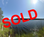
| Price: | SOLD |
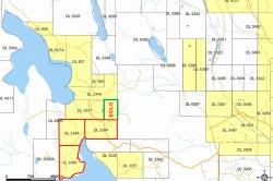
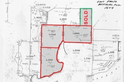
| Legal: | OM 34: District Lot 3350, Coast Range 5, Land District 14 |
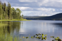
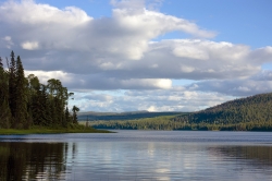
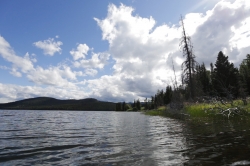
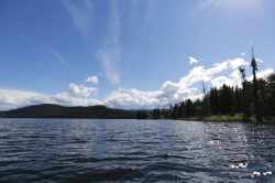
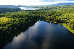
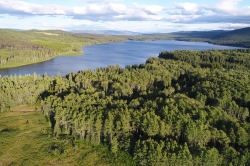
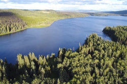
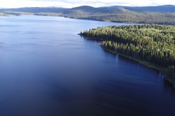
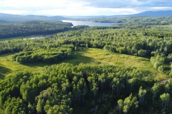
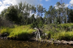
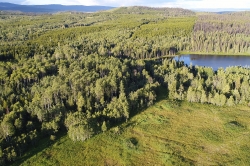
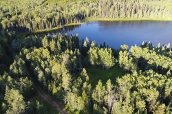
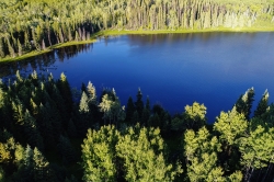
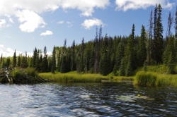
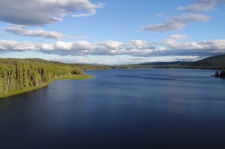
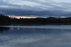
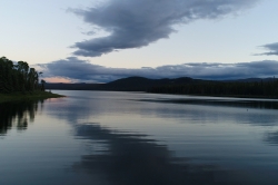
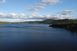
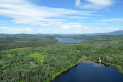
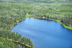
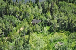
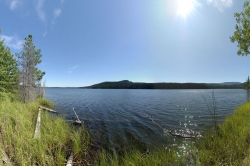
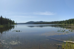
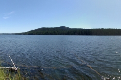
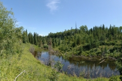
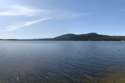
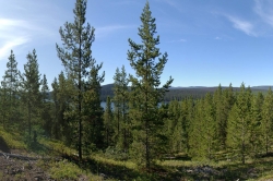
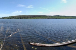
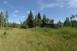
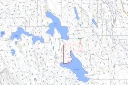
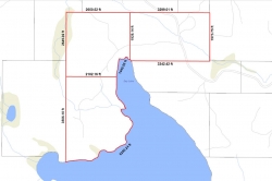
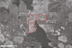
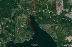
| Description: | This beautiful property is located on the north shore of Day Lake and has approximately 7720 feet (2253 meters) of lake frontage. Most of the frontage has a shoreline with small pebbles and some rocky outcrops and a few weedy areas. A beautiful creek runs through the property and large rainbow trout can be seen in the deep pools. The creek runs from the east to west into the lake in a small bay. The creek is very picturesque with open side hills and a few small waterfalls. The terrain of the property is mostly flat and rolling. The southern part of District Lot 3350 slopes gently to the west and offers a great view of the lake. It is believed that this unique property is one of only two privately owned properties on Day Lake. There is no public access to the lake, giving you your own private fishing spot. There are remains of an old two-storey house only framed with a roof on a full basement. A couple of large sheds are located by the house. There are two old barns on District Lot 3348. There are also a couple of sheds scattered throughout the property. Some old corrals are found around the barns. All of no value. Take a Tour of Day Lake Here |
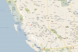
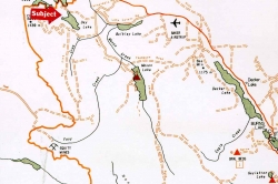
| Location: | Day Lake is located 25 miles (40 km) northwest of the town of Burns Lake and 62 miles (100 km) southeast of Smithers in central British Columbia. Burns Lake is 140 miles (226 km) west of Prince George and Prince George is 488 miles (786 km) northeast of Vancouver. |
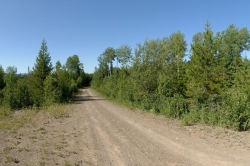
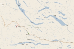
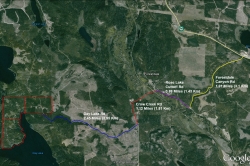
| Access: | Starting from Burns Lake go west towards Houston and Smithers. At 21 miles (34 km) just past Duncan Lake gas stop turn left (south) onto Forestdale Canyon Road (a good all weather gravel road). Travel on this road for 1.91 miles to the Rose Lake Cutoff Road and turn right. Drive 0.88 miles (1.43 km) to Crow Creek Road; turn left and follow the main road over the railroad tracks and Bulkley River. Continue for 1.12 miles (1.81 km) until you see a sign “Day Lake Road”. Turn right and go for 2.45 miles (3.95 km) onto the Day Lake property. The nearest commercial airport is at Smithers, located just over an hour away. Regular air service is provided by Air Canada’s Jazz Airlines, Central Mountain Air, and Northern Thunderbird to Vancouver and other points in British Columbia. The Smithers airport has expanded its runway and upgraded its operations. The major regional airport is at Prince George, located just 3 ½ hours away. The airport has undergone a major expansion, with further renovations to its runways, and international cargo plane fueling capacity, and can now accept 747 airplane landings. The airport has an International Customs and Canada Border Service area and accepts international charter flights. |
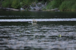
| Recreation: | Day Lake is a secret fishing spot, and on a calm evening you can see the rainbow trout jumping for flies on the water. In the winter, this area is popular for snowmobiling and ice fishing. Many moose and deer have been seen both in the field and by the lake in the evening. To the west is the “Steelhead Capital of Canada”, the convergence of the Morice and Bulkey Rivers with over two dozen productive spots in and around Houston for the famous and feisty steelhead. Not only are the rivers perfect for fly fishing, but the lake systems are also known for steelhead, trout and char. The entire area known as the Lakes District is famous for its excellent fishing and game. There are a number of resorts throughout this area which offer boating, fishing, hiking, horse-back riding, camping, cross country skiing and many other activities. This area is well known for its hunting and wildlife watching opportunities. Deer, moose, wolves, coyotes, bears and eagles can be observed in the area. Close to this area is North Tweedsmuir Provincial Park, one of the most scenic provincial parks in the province. Tweedsmuir Provincial Park appeals primarily to outdoor recreationists interested in boating, angling, camping, hiking or hunting in one of North America’s most magnificent wilderness areas. Outdoor recreation opportunities are almost unlimited. Parts of the park are open to hunting in the fall. |
| Services: | None |
| Area Data: | Houston: With a population of 3200 people, the district municipality has been called the ”Steelhead Capital of Canada” as the productive Bulkey and Morice rivers merge here. However, with fishing, boating, hiking, wilderness watching, and other recreational opportunities located within arms reach in Houston, this area is known as an outdoors paradise. Houston’s economy has grown and diversified in recent decades. It has one of the largest wood processing mills in the country and serves as the home community to many of the workers at the Huckleberry copper mine, located 77.67 miles (125 km) south of Houston. Topley has a general store with gas bar, two restaurants and two service stations. There is a Community Hall and Association and Volunteer Fire Dept. and First Responders. Burns Lake is the nearest community with a population of 3,614 in the village. The first thing that strikes you when you enter this town is the welcoming sign with enormous chainsaw-carved trout and the inscription “Three Thousand Miles of Fishing”. Major industries include forestry and tourism, though many workers commute to jobs in the mining industry. It also serves as the main commercial centre for the surrounding area, offering all retail and financial services, and a hospital. There are many cafes and restaurants, a selection of stores and services, and is location of the head offices of the Regional District of Bulkley-Nechako. Day Lake is located within the Lakes District which is noted for sunny skies and moderate rainfall of less than 20 inches per year. This area is known for clean air, friendly people, inviting lakes, wandering country roads, abundant wildlife and the spectacular beauty of nearby Tweedsmuir Provincial Park. Smithers (pop. 5351) is a key service area for the surrounding communities in the Bulkley Valley. The town is internationally known for its Alpine theme, with all businesses on Main Street required to construct their buildings in an Alpine style. Smithers is home to regional government offices, RCMP detachment, schools, and medical services including the Bulkley Valley Hospital. The local airport, which processes 75,000-85,000 visitors every year, is serviced by Air Canada, Central Mountain Air and Northern Thunderbird air, with connections to Vancouver, Prince George and beyond. Please note that the airport has no Customs facility, and cannot accept trans-border flights. Smithers is also home to a well-established artisan community, and the Bulkley Valley Museum provides you with a trip back into this area’s past. If you’re looking for a more active vacation, Smithers is a fisherman’s dream, with everything from lake trout from the famous Rainbow Alley to salmon and steelhead from the fast flowing Bulkley River. In the summer, golf at the championship-level Smithers Golf Course, hike and bike through the surrounding mountain vistas, and paddle through the hundreds of lakes in the area. Once the snow falls, Hudson Bay Mountain offers the driest powder conditions for skiing and snowboarding in the country, with a trail that will take you right into town. Or, the Smithers Snowmobile Association grooms trails in three areas and maintains six mountain cabins. |
| History: | Day Lake was named for the first settler on the lake, Dan Day, who arrived here sometime between 1912 and 1918 and started a small farm. He always rode a white horse to pick up supplies in Forestdale, which was, as that time, a train station for the Grand Trunk Pacific Railway and small settlement with store, post office, church/school. Most residents worked on the railway and had homesteaded here. |
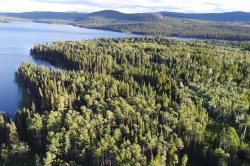
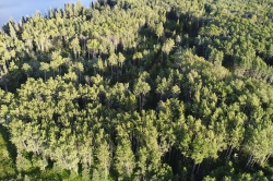
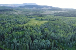
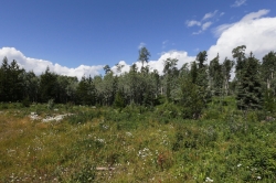
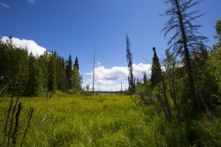
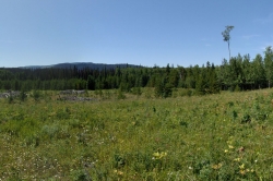
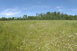
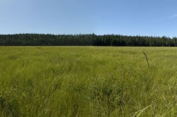
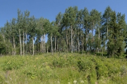
| Vegetation: | Parts of the property were logged of merchantable timber in the late seventies and eighties. A wide buffer zone of large old growth Pine, Spruce, and Aspen trees remains along the lakeside to preserve subdivision value. There is a healthy stand of new Pine growing in most of the previously logged areas with heights ranging from 20-30 feet depending upon the age. There are also some areas of cleared pasture surrounding the old homestead. |
| Investments: | This property is not in the Agricultural Land Reserve and can be subdivided into smaller lakeshore lots. Local zoning restrictions for this property require a minimum lot size of 20 acres. There is no parkland dedication requirement because the project is a rural subdivision with lot sizes greater than 5 acres. This property is capable of producing 21 titles after allowing for the area required for roads/infrastructure. The Ministry of Transportation granted a Preliminary Layout Approval document (PLA) for the construction of a subdivision on this property in 2006 (extended in 2008), however, this expired in 2010. The approved plan would have created 17 twenty acre lakefront lots, and 4 twenty acre non-lakefront lots. Road construction was to be to a gravel Class D MOT road, and the creek crossing was achieved by using an Armtec open-bottom culvert Mini-Span bridge. Power as a development feature was optional and cost needed to be weighed against increased return on property sales. Existing power is approximately 2.48 miles (4 km) from the property. Plans, onsite waste surveys, and appraisals for the development project were completed. Detailed data will be shared with qualified purchasers that complete a confidentiality agreement. This land could be improved into a very unique and private guest ranch. A creek runs through the property and Lot 3350 has two well-sheltered bays. The new pine growth offers a great opportunity for a small tree farm. |
| Boundaries: | Boundaries surveyed by J.M. Milligan in September, 1910, 1912 & by V. Schjelderup in September, 1924 |
| Taxes: | OM 34: $505.39 Total: $1603.83 (2019) |
| Zoning: | District Lot 3348,3350, 3384 – Large Holdings (H2) |
