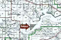
Cluculz Lake Acreages
| Listing Number: | PRINCE GEORGE 3 |
|---|---|
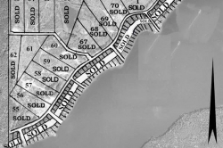
| Price: | SOLD |
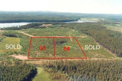
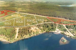
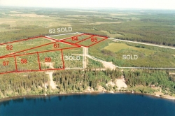
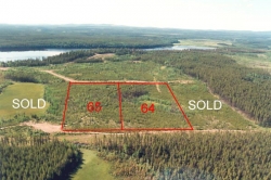
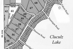
| Legal: | Lots 61 and 65, District Lot 1135, Plan 26769, L.D. 05, Cariboo. |
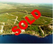
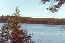
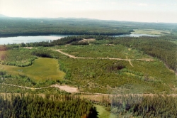
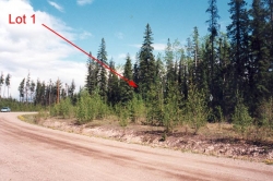
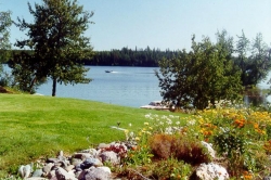
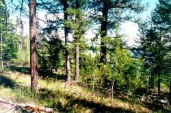
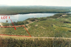
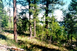
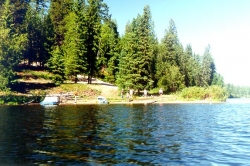
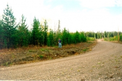
| Description: | These lots are gently rolling and covered with new growth pine approximately 15 ft- 30 ft high and many of them offer beautiful views of the lake. It is only a short 5- minute walk to the lake from any of these lots. The lots have been perc tested. |
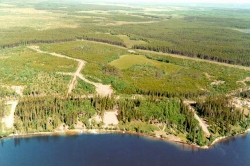
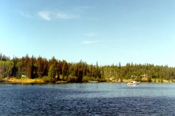
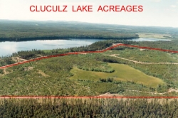
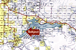
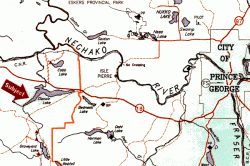
| Location: | The subdivision is located on the northwest shore of Cluculz Lake, which is located 42 miles (67 kilometres) west of Prince George and 20 miles (32 kilometres) east of Vanderhoof, just south of Highway #16, in central British Columbia. Prince George is 488 miles (786 kilometres) by car from Vancouver. |
| Access: | From Highway #16, [42 miles (67.5 kilometres) west of Prince George or 20 miles (32.1 kilometres) east of Vanderhoof] turn south on Meier Road and continue on this paved road for approximately 4.5 km, turn right, off the paved road, onto West Meier Road and continue approx. 2.2 km to the end of the road where the subdivision starts. |
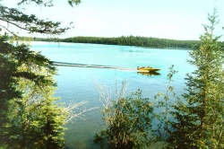
| Recreation: | This area is extremely popular for many recreational activities, including all sorts of water/boating sports in summer and snow sports in winter. Fishing in Cluculz Lake is good for rainbow trout, lake trout, kokanee and some ling cod. It is about fifteen kilometers long and up to two kilometers wide and has a number of different resorts and fishing camps along it’s shores. For more information on fishing in the Cluculz Lake Region, click here |
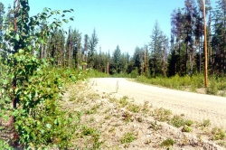
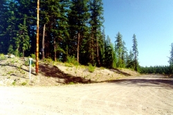
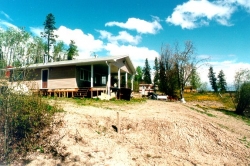
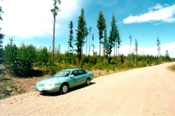
| Services: | Maintained gravel, year-round roads, hydro, telephone and school bus. |
| Area Data: | Cluculz Lake is one of the favourite recreational lakes in the Prince George/Vanderhoof area, with numerous summer cabins and year-round residents throughout the area. The surrounding area north and west of the property. Is mostly small cattle ranches with cow/calf operations. Cluculz Lake is approximately 10 miles (16 kilometres) in length, east to west, and in its widest point is approximately 1.25 miles (2 kilometres). The surrounding area is very flat and there are only two mountains, Bobtail Mtn., 20 miles (32 kilometres) to the south, and Sinkut Mtn. to the west, both with an elevation of 1,400 ft. The balance of the country is flat and level. The Nechako River which flows into the Fraser River at Prince George is 7 miles (11 kilometres) to the north of the property. There are several lakes in the surrounding area; 12 miles (19 kilometres) west of the property are Bednesti Lake and Norman Lake, both approximately 3 miles (4.8 kilometres) long; 8 miles south is Eulatazella Lake, being 2.5 miles ( 4 kilometres) long; and 15 miles (24 kilometres) to the south is Naltesby Lake, 6 miles (9 kilometres) long. Benesti and Norman Lakes are also popular for recreational use, with a number of summer cabins. Prince George , with a population of 90,000, is located at the junction of the Fraser and Nechako Rivers, Highways #16 and #97, and the Canadian National and B.C. Railways, making this city the central transportation hub of northern B.C. Prince George is home to the University of Northern British Columbia, one of Canada’s newest universities. An influx of people has already moved into the city spurring downtown rejuvenation; as well, new homes, shopping and recreational facilities and cappuccino shops are springing up in areas throughout the city. Vanderhoof is located at the junction of Highway #16 and Highway #27 and is the geographic centre of the province. The population is approximately 3,500. Forestry is the number one industry with agriculture being second. Vanderhoof is in a rich, fertile valley known for its cattle ranches and dairy arms. The area is served by rail and air (land and float planes) and is rich in recreational opportunities, both indoor and out, e.g. hockey and skating arena, golf and country club, softball diamonds, indoor riding arena, olympic gym, cross country ski trails, swimming pool, curling rink, tennis courts, bowling alley and billiard hall. Murray Ridge Ski Hill is located 37 miles (60 kilometres) away providing downhill skiing throughout the winter. |
| History: | Ft. George, as Prince George was first known, was constructed by Simon Fraser in 1807 as a North West Company Trading Post, and then as a Hudson’s Bay Trading Post till 1915. The arrival of the railroad in 1914 created a real estate boom. Ft. George was renamed Prince George in the first civic election of 1915. It became a major logging, saw and pulpmill town, centre of the white spruce industry in central B.C. in the 1940s. In 1951 Prince George was connected with Dawson Creek and the Alaska Highway by the Hart Highway. Vanderhoof: This town was named after Herbert Vanderhoof, a Chicago publicity agent. In 1908 Vanderhoof was engaged by the Canadian government, the Canadian Pacific Railway, the Canadian Northern Railway and the Grand Trunk Pacific Railway to conduct a major campaign to draw settlers to western Canada. He was very successful and in 1914 the settlement was given his name. In 1926 the Village of Vanderhoof was born. Vanderhoof continued to grow in the 1940’s, with the rise of lumber prices and the arrival of new people. The Kenney Dam was constructed in the 1950’s, boosting the economy and population, and since that time the town has enjoyed a steady growth. |
| Vegetation: | The sub-shore lots are covered with new growth pine, approximately 15 ft. – 25 ft. high. The Ministry of Agriculture soil maps reveal the soils are basic glacial till, which means great growing! |
| Taxes: | 0.00 |
| Zoning: | Small Holdings (H1) |
