Anser Lake
| Listing Number: | PR 20 |
|---|---|
| Size: | 145 Acres |
| Map Reference: | 103J |
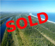
| Price: | SOLD |
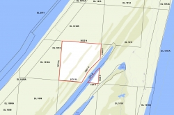
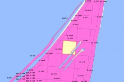
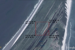
| Legal: | Southeast 1/4, District Lot 1012, Queen Charlotte Land District 46. |
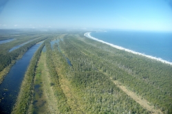
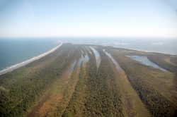
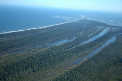
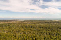
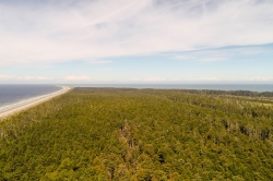
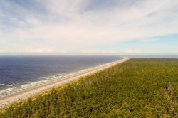
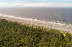
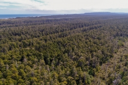
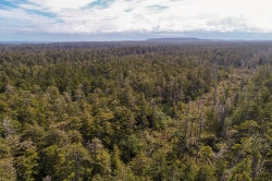
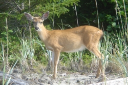
| Description: | The property is square in shape with a series of finger-like lakes between patches of treed ground. The Sitka spruce can soar over 180 feet above your head, and every step you take in this awesome forest sinks you deeper and deeper into a bed of dark green moss. This area is home to a wild Sitka Blacktail deer population and on an evening drive seeing 30 deer is a common occurrence. Nearby Rose Spit is an excellent spot for observing migrating birds travelling south on the Pacific Flyway. |
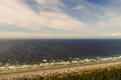
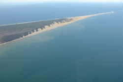
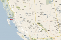
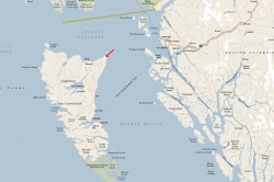
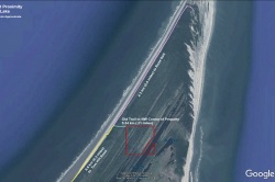
| Location: | The property is located approximately 21 miles (33.7 km) from Masset and 2.6 miles (4.3 km) from Rose Spit, within Naikoon Provincial Park on the northeast tip of Graham Island on Haida Gwaii (also known as the Queen Charlotte Islands). |
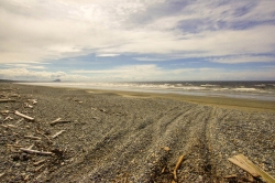
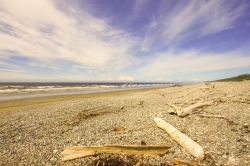
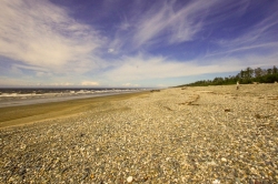
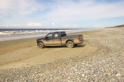
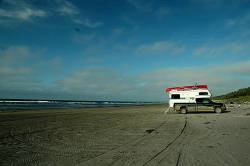
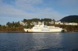
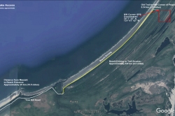
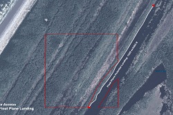
| Access: | Haida Gwaii is accessible by plane or ferry with daily flights on Air Canada to Sandspit (on Moresby Island) from Vancouver. There is also air service from Vancouver to Masset with Pacific Coastal Airlines. Masset airport also accommodates private jets and helicopters. For those coming from Northern BC, North Pacific Seaplanes offers air service from Prince Rupert to Masset. BC Ferries offers service from Prince Rupert with 4 sailings a week in summer and 3 in winter from Prince Rupert to Skidegate on Graham Island on Haida Gwaii. Sailing time is approximately 6 hours. Rental cars are available in Sandspit, Masset and Queen Charlotte City. There are two ways in which the property can be accessed. Vehicle: From Sandspit drive 6 miles (10 km) to the Kwuna ferry to Skidegate. Once at Skidegate, travel north to Masset on Highway 16 for 63 miles (101 km). From Masset travel on partially paved Tow Hill Road, to North Beach access to the property. There is no legal road access into this property, however, at the present time there is the remains of an old trail to the beach from the property. Travel approximately 15.5 miles (25 km) from Masset to the North Beach turnoff at Tow Hill, and drive another approximate 5.3 (8.5 km) miles on North Beach to the beginnings of the old trail. It is a further 0.21 miles (0.34 km) to the northwest corner of the property. Float Plane: Anser Lake is accessible by float plane. Flights can be arranged with Inland Air to take parties to Anser Lake from various locations on Haida Gwaii or from Prince Rupert. A dock could be installed for easier access to the property. |
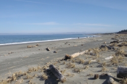
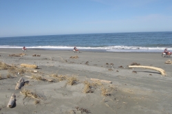
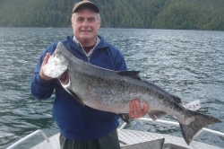
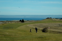
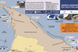
| Recreation: | Haida Gwaii is world-renowned for their fishing, both fresh and saltwater. There are freshwater streams to tempt the avid fly-fisher as well as the majestic Pacific Ocean to lure adventurous fishermen to this unique region. This area is a legend among sports fishermen worldwide with numerous first class fishing lodges attracting hundreds of visitors every year. The avid fishing enthusiast can play in this coastal playground all year round, attracting all five species of Salmon, plus Steelhead, Trout and Halibut. One can anticipate catching spring salmon upwards to 60 lbs while Halibut on the Island have topped 40 lbs. Starting in mid-May, the fish appear on the northern Graham Island coast and follow the herring and needlefish down the coastline. Coho show up in early July, and can be found in abundance by late August. Steelhead are the winter catch on the islands, with the first run showing up in October, and running through to March with the peak months being December and January. The Sangan River is famous for its fly fishing opportunities for Salmon, Cutthroat Trout and Dolly Varden. Fishermen come from all parts of the world to the Tlell and Yakoun Rivers for the Steelhead run. Crabbing and clam digging along North Beach is a popular past time year round on Graham Island. Razor clams and dungeness crabs are abundant, and can be collected to create world class dinners. Hiking, biking and walking on the beaches, trails, or in your own backyard provides enjoyment as well as relaxation for outdoor enthusiasts. Exploring the wonders of the rainforest is something the whole family can enjoy year round in this coastal paradise. Naikoon Provincial Park, one of two provincial parks on Graham Island, consists of 72,660 ha (179,493 acres) of low wetlands and superb sand dunes, with forests thriving only along river valleys and hills. Naikoon reaches out into Hecate Strait and culminates in Rose Spit, an ecological reserve and excellent spot for watching birds migrating south. Naikoon Park is known for its beautiful scenery, excellent hiking trails and wilderness campsites. Haida Gwaii is considered a hidden gem for surfers, with the surfing season running May through October, beginning with the Expression Sessions festival held in late October—November. Surfing rentals and expert advice can be found in Masset. One well known hiking and recreational trail is the East Beach Trail route through Naikoon Provincial Park, which follows the eastern shoreline of Graham Island from just north of Tlell to Tow Hill near Masset. This remote coastal beach trail is one of the most magnificent trails in Canada. While it is possible to drive along East and North Beaches, any drive must be undertaken at low tide, as sections of the hike along the east coast are bordered by cliffs where the high tide comes right up to shore with no escape routes. Please note, East Beach is a remote wilderness area. There are no shortcuts off East Beach, with limited cell phone coverage. The complete trail takes approximately 4 to 8 days to hike, and can be challenging. Several rivers and streams must be crossed, and distances between the rustic shelters along the hikes can be far. The Cape Fife trail to Tow Hill, while considerably shorter than going around Rose Spit, has numerous marshes and boggy sections to cross, with many fallen trees to go over or under. This is a hike-in trail only. To view BC Parks information on the East Beach Trail, click here. To view BC Parks information on the Cape Fife Trail, click here. For those looking for time on the links, Dixon Entrance Golf and Country Club, located only minutes away, is Canada’s most northwesterly 9 hole golf course. Haida Gwaii is well known for its abundant wildlife, especially hundreds of small deer. Seeing fifty to sixty in a day is not uncommon while spotting a herd of elk in remote areas is customary on these islands. |
| Services: | None. |
| Area Data: | Haida Gwaii (Queen Charlotte Islands) are a triangular archipelago of some 200 islands, most of them small and uninhabited, covering an area of 9,596 sq. km, running (251 km) 156 miles from south to north, and (84 km) 52 miles west to east. They are separated from the mainland by Hecate Strait, to the north, ranging in width from (50km) 31 feet to (130km) 81 miles. The largest islands are Graham to the north, and Moresby to the south. Graham Island is the largest, most accessible, and most populated of Haida Gwaii. The average actual rainfall is higher than the average actual rainfall at Vancouver International Airport, but less than that of North Vancouver. The isolation and climate make the islands distinctly different from the mainland and permit unique subspecies to thrive here. Luxurious rain forests, shell scattered shorelines and sandy beaches provide superlative wilderness adventures. Masset (Pop. 884) is 25 miles (40 km) north of Port Clements. Masset, on Masset Sound is the largest community on Graham Island. Located at the end of Highway 16, amenities include full tourist services, restaurants, accommodations, RV park open year-round and groceries. Boat launching and moorage facilities are available along with Canada’s most northwesterly 18 hole golf course Dixon Entrance Golf and Country Club. Visit Old Masset, only minutes away where local Haida artists display their silver, gold, argillite carvings and jewelry. Road access available to the north end of Naikoon Provincial Park on Tow Hill Road. Tow Hill’s (109 meter) 358 feet basalt cliff is the most prominent landmark on the northeast coast. The immediate property area was settled in the early 1900’s with the area around Silver Lake being a 1500 acre ranch on which beef cattle were bred. This property was originally accessed by an old wagon trail known as the “Carr & Whittle” trail, which went from the beach to the Silver Lake area. At one time the hard packed beach area served as a roadway for the extraction of forest products. |
| History: | The Haida First Nation people have lived on Haida Gwaii for thousands of years. They have been referred to as the Vikings of the Northwest Pacific for their seafaring prowess. They are also well known as skilled artists, importing raw materials from the mainland and transforming them into amazing works that could still be functional. Today there are two major Haida communities left on Haida Gwaii, Old Masset and Skidegate. Both communities are vital to the island’s major industries, while preserving their cultural heritage. Haida Gwaii was the first place in British Columbia discovered and recorded by a European, Juan Perez, in July 1774. In 1787, British explorer Captain George Dixon named the islands Queen Charlotte after his ship and his Queen. In 2009, the Queen Charlotte Islands were offically renamed Haida Gwaii. |
| Vegetation: | The timbered area includes 119 acres of cedar, hemlock, spruce and cypress. |
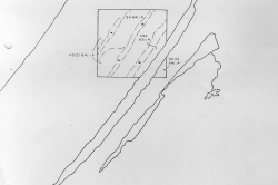
| Boundaries: | Surveyed by C de B Green in August 1910. |
| Taxes: | $486.14 (2019) |
| Zoning: | A-1 (Agriculture-Forestry District) |
