Stay in touch with NIHO!


| Listing Number: | Prince Rupert 38 |
|---|---|
| Size: | 124 Acres (50.18 Hectares) |
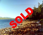
| Price: | SOLD |
| Legal: | District Lot 1770, Coast District, Range 5, Land District 14 |
| Description: | The property rises from Dries Inlet to a level bench covered with old growth timber, slowly to the west. The west part of the property is large open meadows. From these meadows a person can see Dries Inlet. These meadows have small creeks and ponds throughout, some areas are wet, and the majority of these meadows are thickly covered with mosses. Dries Inlet is very quiet and protected. There are several small creeks on the property. Within a half mile radius of the property there are four small lakes, 10-15 acres (4-6 hectares) in size. There is approximately 1,643 ft. of ocean frontage.
Improvements There are no improvements on this property of any value, only the remains of an old log house, close to the ocean. |
| Location: | The property is located on Porcher Island approximately 27 miles (43 kilometres) southwest of the City of Prince Rupert. Prince Rupert is 496 air miles (798 kilometres) north of Vancouver. The property is located in Dries Inlet, just north of Kitkatla Inlet, which is near the central west part of Porcher Island. Porcher Island is approximately 20 miles (32 kilometres) long by 20 miles wide. The northern tip of Porcher Island is 13 miles (20 kilometres) southwest of the City of Prince Rupert. Porcher Island is separated from the mainland by Telegraph Passage, approximately 6 miles (9.65 kilometres) in width, near the north of Porcher Island, and approximately 3 miles (4.8 kilometres) near the southern part by Ogden Channel. |
| Access: | The property is located 27 air miles (43 kilometres) southwest of Prince Rupert. Inland Air Charters operates float plane service from Prince Rupert to the the Village of Kitkatla on Dolphin Island, which is 13 miles (20 kilometres) southeast of the property. A boat can be launched ten miles (16 kilometres) south of Prince Rupert at Port Edward, proceed south on Inverness Passage to Telegraph Passage, down the Ogden Channel to Kitkatla Channel, northwest to Kitkatla Inlet and then to Dries Inlet, to the property. It is approximately 50 miles (80 kilometres) by boat along a sheltered route. |
| Recreation: | This region supports blacktail deer, martin, ducks, geese and many eagles. The beaches have very good clams and mussels and the local waters offer good salmon, halibut, cod and crab fishing, as well as prawns and shrimp. Fishermen from as far away as Vancouver come to Porcher Island for the salmon fishing. The area offers great fishing for chinook, coho, pink, chum, sockeye and halibut, as well as rainbow and cutthroat trout in the local streams and lakes. |
| Services: | None |
| Area Data: | Porcher Island is a large coastal island approximately 16 miles (25 kilometres) south of Prince Rupert and 3 miles (5 kms) from the mainland. The shores of this island are generally flat with good beaches, while the interior of the island has several hills and Egeria Mountain is the tallest reaching to 2,915 feet. There are three small communities on the island – Hunts Inlet, Oona River (the largest) and the village of Porcher Island, and these settlements are mainly dependent on the fishing industry. Besides the three communities, there are a number of year-round residences and some seasonal residences throughout this island. Prince Rupert is a city with a population of 15,000 people making it the largest community on the northwest coast. It is an important service centre for fish processing plants, as well as a significant rail terminus, shipping harbour and home to a large fishing fleet. Prince Rupert is also a major port for the loading of export logs destined for overseas markets. B.C. Ferries sails the Inside Passage year-round, between Prince Rupert and Port Hardy and also from Prince Rupert to Skidegate on the Queen Charlotte Islands. Tourism is a major business in Prince Rupert with over a quarter of a million visitors passing through each year. Deluxe, explorer-class cruise ships base their summer operations in Prince Rupert and visitors congregate here to begin exotic wilderness cruises in enchanting northern passages to Alaska or the Queen Charlotte Islands. Transportation facilities are comprehensive – several freight lines service all continental locations; Greyhound Bus Lines offer regional, provincial and national service, CNR and Via Rail offer rail service, there are two airports, marine highways, tug services and rail barge services. The Queen Charlotte Islands to the west of Porcher, often called the “Canadian Galapagos”, face Japan across the vast open Pacific Ocean. There are many out-of-the-ordinary natural attractions on these islands – bald eagles, seabirds, blacktail deer and seals – and one of the world’s finest collections of native Indian argillite totem poles at the Skidegate Museum. |
| History: | Porcher Island was named after Commander E.A. Porcher, who was on this coast in 1865-68 commanding H.M.S. Sparrowhawk. When the development of the port city of Prince Rupert was announced, people came from all over the continent to settle; but not all of them lived in the city itself and by 1907 there were dozens of homesteaders on the islands off the mouth of the Skeena River. Small communities sprang up, many of them on Porcher Island. Porcher was first settled by mostly Swedish and Norwegian pioneers who grew bountiful crops of fruit and vegetables and raised sheep, due to the islands temperate climate. Humpback Bay is the site of the abandoned Porcher Island Cannery, erected in 1929; however, it was not an auspicious year to begin a cannery, being the beginning of the Great Depression. Four years later the plant was taken over by the Canadian Fishing Company, but used only as a fishing station, that is, a supply depot for local fishermen to buy and sell fish and store their nets. Today the site is privately owned, and some of the cannery buildings still stand. |
| Vegetation: | There is a large strip of old growth forest along the front of the property adjacent to Dries Inlet. The trees along the ocean are large spruce, hemlock and cedar. The meadows in the centre and in the west end have scattered patches of pine and cedar to about 20 feet. |
| Taxes: | $160.70 (2009) |
| Zoning: | No Zoning The original survey lines were run by N.F. Townsend, British Columbia Land Surveyor, July 31, 1908 |
| Sold Date: | 10/12/2009 |